Welcome
The Church Commissioners for England are bringing forward proposals for new homes, employment space, public green spaces and supporting infrastructure at Highflyer Farm North, Ely.
Below, you’ll find more information on the site and our plans.
Introducing the Church Commissioners
for England
The Church Commissioners for England are a registered charity established in 1948 to support the Church of England’s ministry, particularly in areas of need and opportunity. They do this through responsible and ethical management investments including land.

The Church Commissioners for England’s Strategic Land Team looks to bring forward land for development across the country working closely with local authorities to meet local needs.
The Commissioners aim to ensure their residential developments meet five core values for housing, that they should be Safe, Stable, Sociable, Satisfying and Sustainable.
These aims underpin their requirements for design from the earliest stages of development, as well as how they manage relationships with developer partners to ensure the creation of high quality, affordable and appropriate housing.
The Site and Planning Context
Site Description
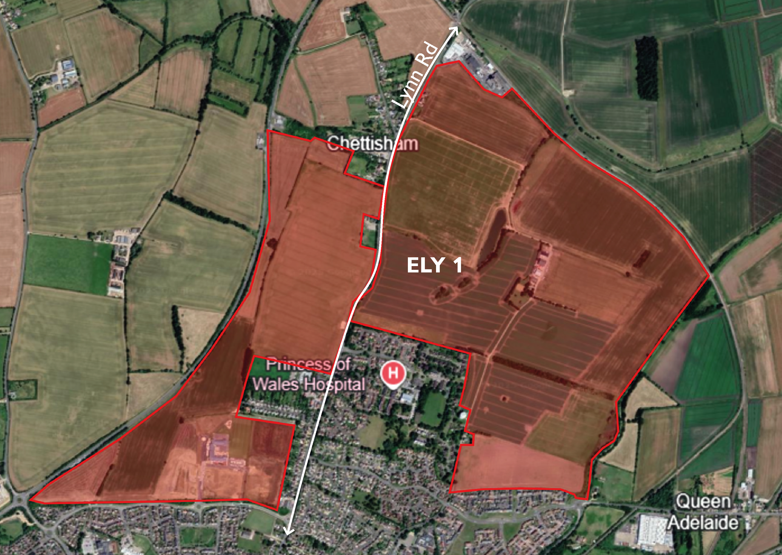
Highflyer Farm North is located north of Ely, and is bound by Lynn Road to the west, residential development to the south and the railway line to the north. It is the final part of the ELY 1 residential allocation in the East Cambridgeshire Local Plan (2015, as amended 2023) to come forward.
The site extends to c. 85ha and forms part of a larger allocation (ELY 1) for housing in the adopted East Cambridgeshire Local Plan (2015, as amended 2023).
The plan above identifies the parcels of land within this allocation that have been brought forward previously by the Church Commissioners.
The land outlined in red (Highflyer Farm North) is the focus of this consultation and will be subject to an outline planning application.
Highflyer Farm to the south (outlined in yellow and blue) already has outline planning permission for up to 800 homes and a reserved matters permission for 200 of those homes. Phase 1 of this permission (outlined in yellow) is complete. The remaining phases of this permission (outlined in blue) will be the subject of a forthcoming reserved matters application.
Site location plan
East Cambridgeshire District Local Plan
The East Cambridgeshire District Local Plan was adopted by East Cambridgeshire District Council in 2015 and amended on a single issue in 2023.
The Local Plan sets out a blueprint for the future growth of the region, including the location and how much development should take place. Development should be sustainable and meet the needs of the local area.
To do this, the plan allocates areas of land for development. Highflyer Farm North forms part of the ELY 1 allocation for a “housing-led sustainable urban extension” of North Ely.
The ELY 1 site allocation covers an area of 210 ha north of Ely, and is allocated for a mixed-use urban extension, comprising approximately 3,000 dwellings, two primary schools, two local centres incorporating retail and community facilities, an extension to Ely Country Park and an extension to Chettisham Business Park.
Ely 1 allocation
The North Ely Supplementary Planning Document (SPD) was adopted in 2014, following consultation with local residents. The document sets out guidelines for the development of an urban extension to the north of Ely, providing further details and proposed masterplan for the site.
In particular, the application site is identified within the SPD masterplan for residential dwellings, an extension to Chettisham Business Park and an extension to Ely Country Park.
Planning History
The portion of the Ely 1 allocation west of Lynn Road has been brought forward by Endurance Estates and was granted outline approval for 1,200 homes in June 2016.
The Church Commissioners were the landowners and promoters of the land east of Lynn Road, also known as Highflyer Farm. The southern part of this land was granted outline permission in 2015 for 800 homes, a local centre, a school and supporting infrastructure. The first phase of 200 homes, accessed from Kings Avenue has been completed.
Highflyer Farm North, the land subject to this public consultation, represents the final phase of development of the Ely 1 allocation. The delivery of these proposals will be coordinated with development to the south, particularly where the proposals connect with the proposed spine road.
Indicative layout of Endurance Estates land (left side) and Highflyer Farm (right side) , (Ely SPD, 2014).
Design Principles
Traces on the land
Reinstating Tea Close as a meaningful open space reflecting the site’s historic landscape.

Retaining and enhancing existing trees, hedgerows, and historic landscape features.


Using historic field patterns and footpaths to shape the layout and re-establish connections across the site.
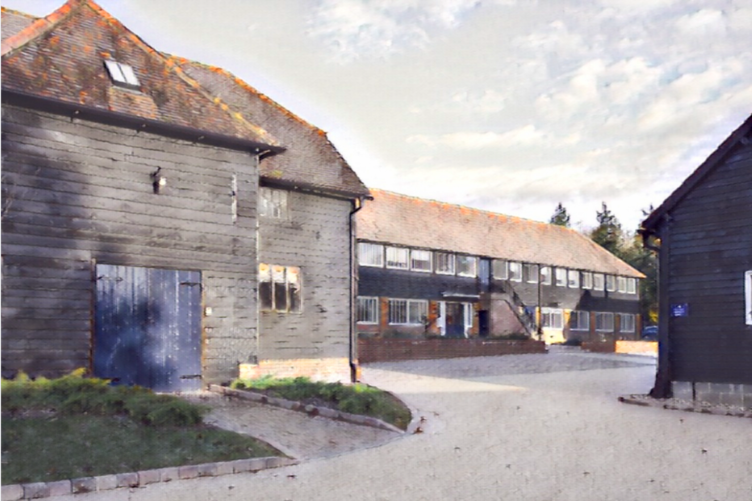
Retaining and sensitively integrating the Highflyer Farm building as a local heritage landmark.

Views and Visibility
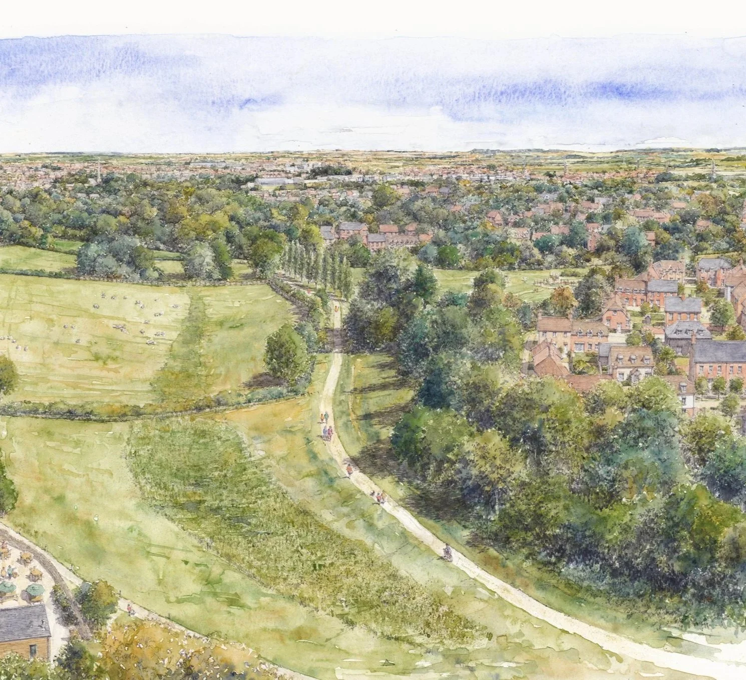
Maintaining long views towards the Fens and framing key views of Ely Cathedral to the south.

Minimising and sensitively managing visual impacts both from and towards the site.

Introducing planting or landform to screen visual constraints and soften edges.
Enhancing external views into the site while using visual barriers to define sensitive edges.

Landscape and Topography
Working with existing topography, respecting ridge-lines, slope direction, and natural landform.

Strengthening tree edges and hedgerows to reinforce the landscape structure.

Integrating sustainable drainage systems (SuDS) and watercourses with the natural direction of water conveyance.

Designing green infrastructure to respond to surface water flooding.

Enhancing Connectivity
Defining and strengthening a network of green corridors and links.

Defining primary and secondary routes, access points, and connections.

Providing a separate access point to Chettisham Business Park extension.

Creating pedestrian and cycle connections linking into the local footpath and active travel network.

Illustrative Masterplan
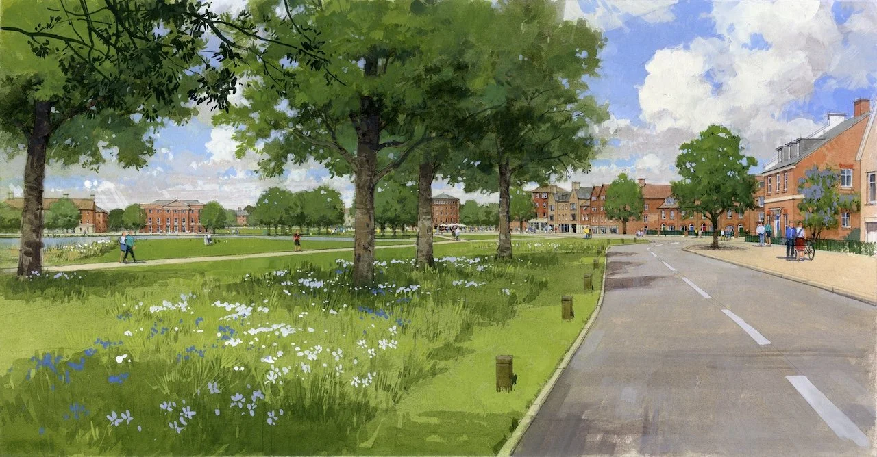
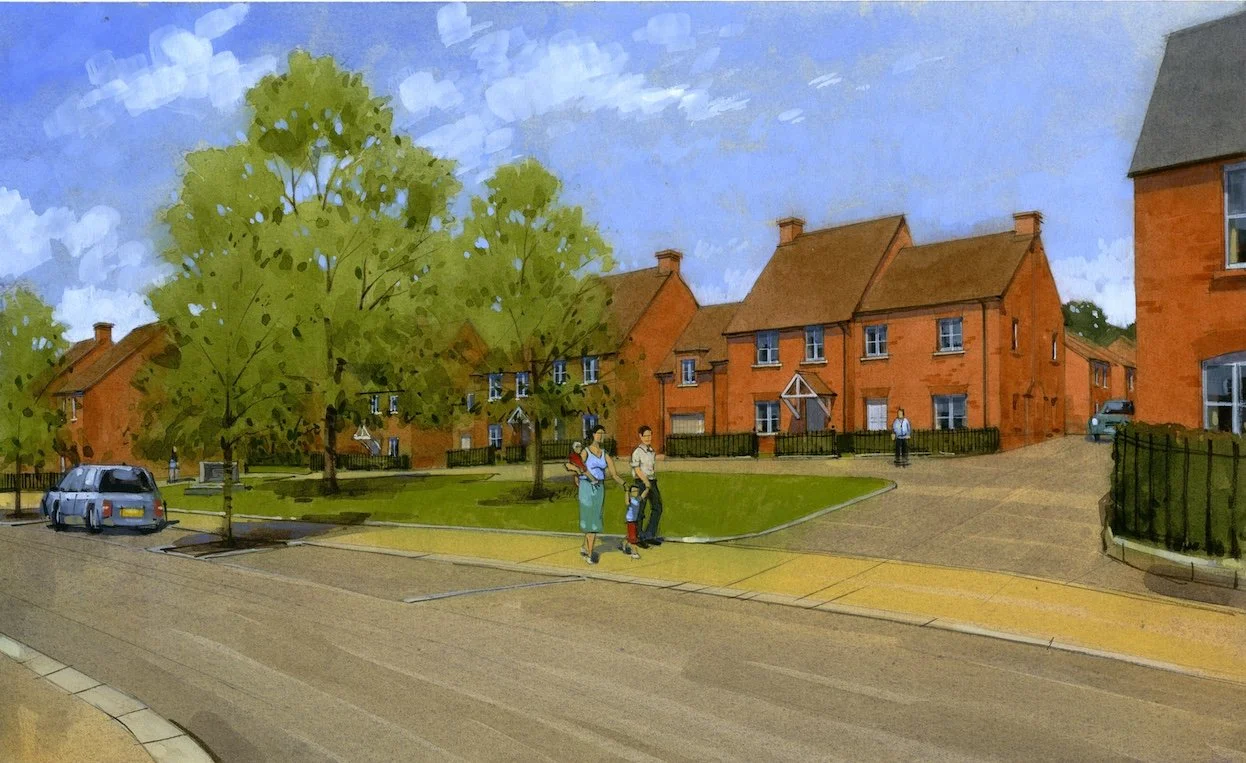
Up to 1,610 new homes, including affordable housing, in a mix of types and tenures to meet local needs and create a diverse & inclusive community.
Appropriate building heights and density, with high-quality design that complements Ely’s character and wider landscape.
Extension of the Chettisham Business Park to support local employment opportunities.
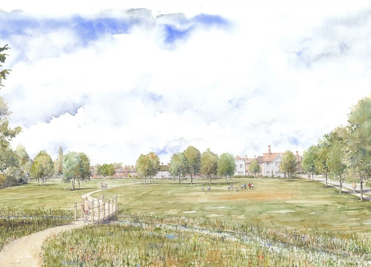
Accessible green space – including an extension to Ely Country Park , community allotments, playgrounds and public open space, making up around 45% of the site.
New and enhanced green links, connecting into existing public rights of way, preserving the historic footpath across the site, and providing safe walking and cycling routes.
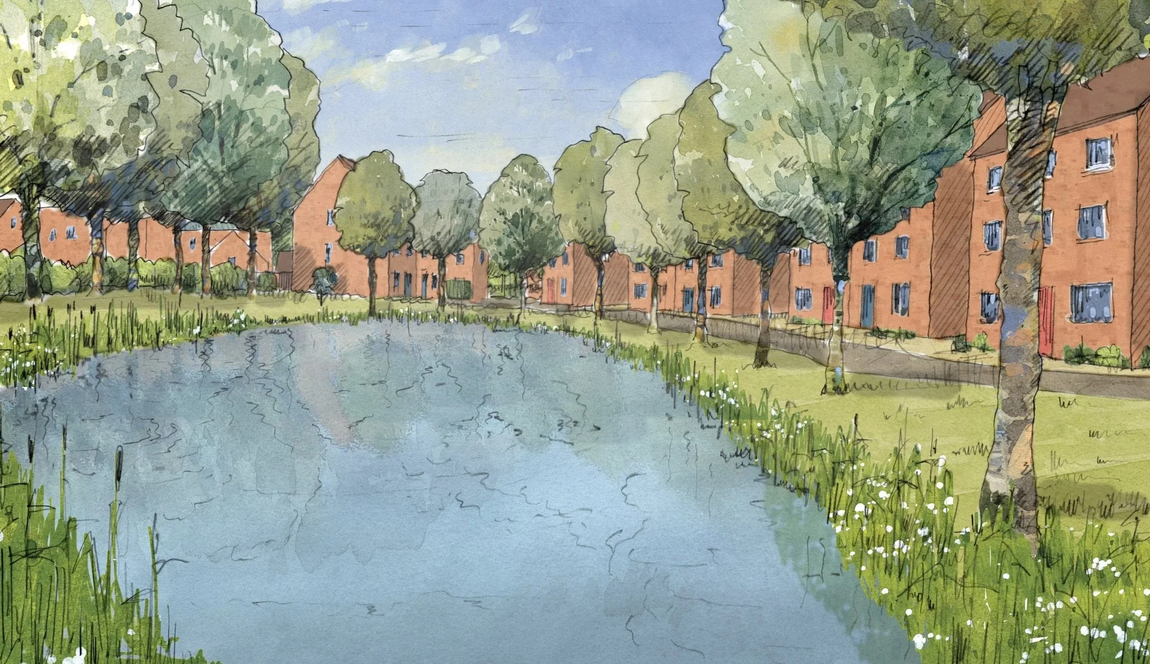
Integrated Sustainable Drainage System (SuDS) to manage water naturally, reduce flood risk and adapt to climate change.
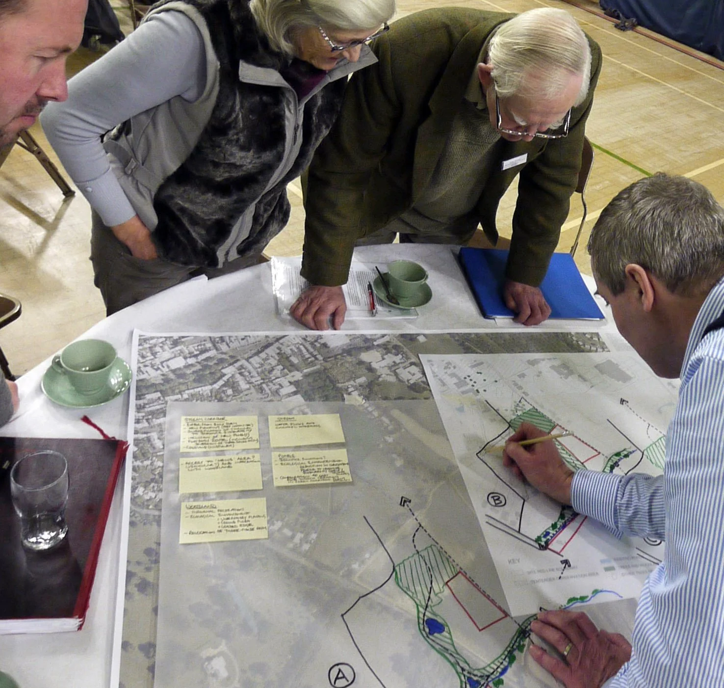
Next Steps
The public consultation is now closed.
We will consider everything we hear over the following months, before we finalise our plans and submit a planning application next year.
Get in Touch
Please let us know if you have any questions about anything included either on the website or in our plans. You can do this by:
Email us: ukdeloitteconsultation@deloitte.co.uk


The timescales set out herein are indicative only and remain subject to the determination of outline planning application and subsequent approval of reserved matters.